The fascinating history of the Nardoo Trail
The Nardoo Trail in Wedderburn offers a delightful blend of natural beauty, rich history, and small-town charm. This picturesque walking path along Nardoo Creek provides visitors with a unique opportunity to immerse themselves in the peaceful Australian countryside while learning about the area’s fascinating gold rush heritage.
A walk through time
Originally part of the Torpichen Station, the Nardoo Creek area underwent a dramatic transformation after gold was discovered in 1852. The ensuing gold rush brought prospectors from far and wide, hoping to strike it rich in the region’s alluvial gullies. Some of the world’s largest gold nuggets have been found nearby, including the famous ‘Hand of Faith’ near Kingower and the ‘Welcome Stranger’ at Moliagul.
Today, Wedderburn exudes a quieter, more relaxed atmosphere, but remnants of its golden past can still be seen in the town’s architecture and occasionally unearthed nuggets. The Nardoo Trail offers a perfect starting point for exploring this captivating history.
What to expect on your walk
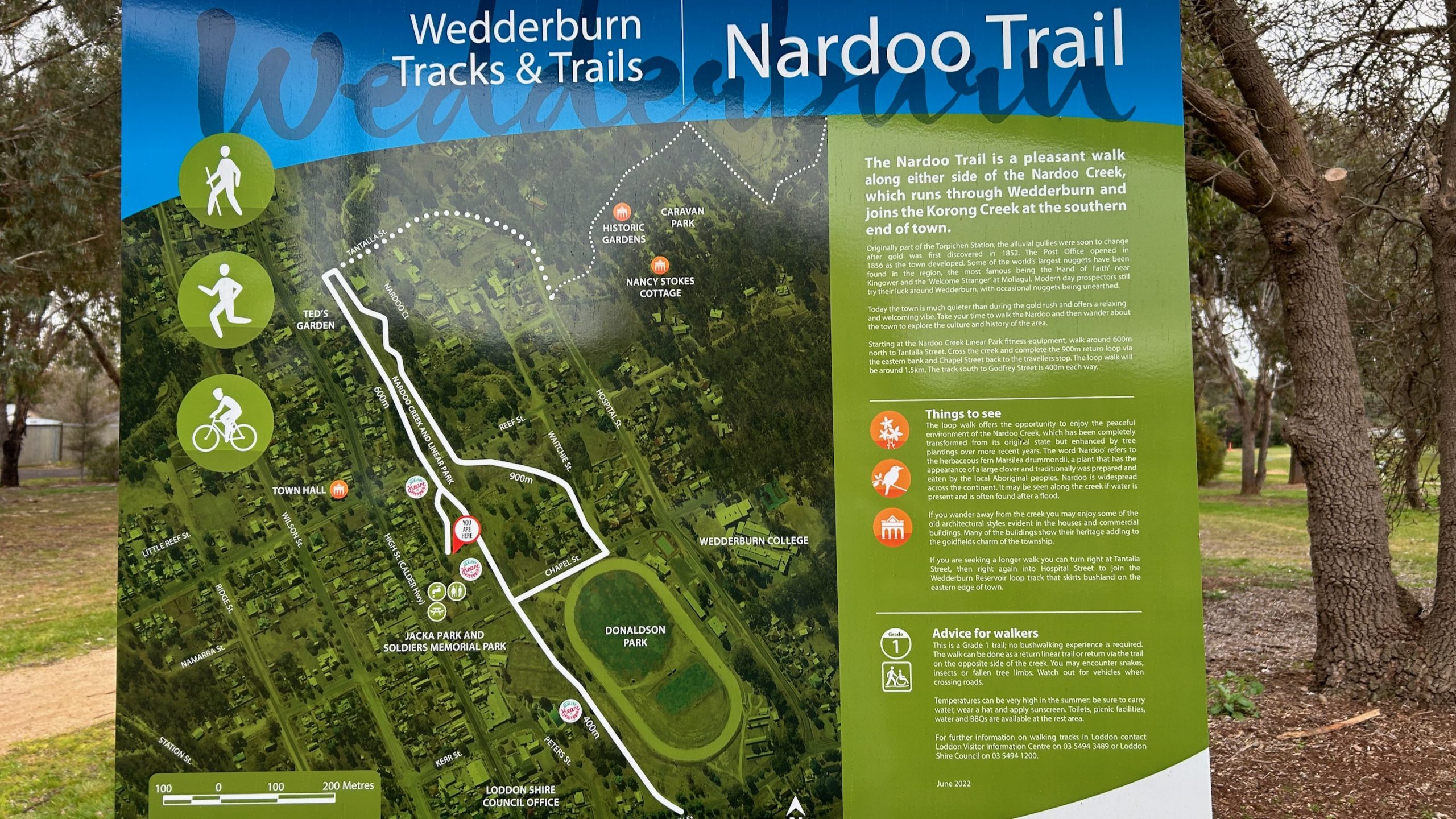
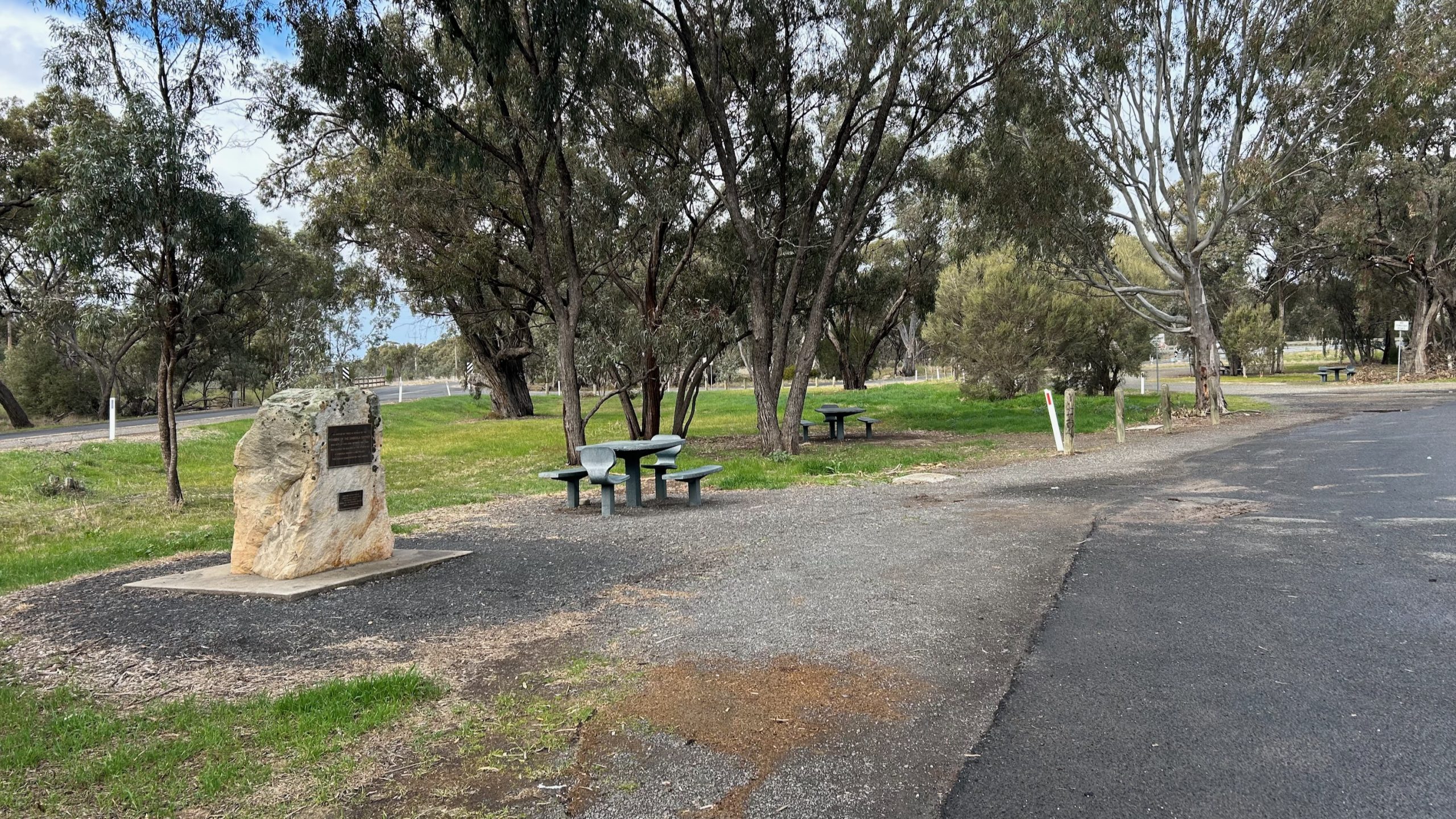
The Nardoo Trail is a Grade 1 trail, making it accessible for walkers of all experience levels. The main loop walk covers approximately 1.5km, starting at the travelers stop on Chapel Street. As you stroll along either side of Nardoo Creek, you’ll be treated to a transformed landscape, enhanced by recent tree plantings that have created a peaceful environment.
Keep an eye out for the trail’s namesake – the Nardoo plant (Marsilea drummondii). This fascinating herbaceous fern resembles a large clover and holds cultural significance for local Aboriginal people, who traditionally prepared and ate it.
Beyond the creek
While the creek itself is a highlight, venturing away from the water reveals even more treasures. Wedderburn’s streets showcase charming old architectural styles, with many buildings proudly displaying their heritage and contributing to the town’s goldfields charm.
For those seeking a longer adventure, extend your walk by turning right at Tantalla Street and right again into Hospital Street. This route connects you to the Wedderburn Reservoir loop track, which skirts bushland on the eastern edge of town.
Practical tips for walkers
Before setting out on the Nardoo Trail, keep these helpful tips in mind:
- Be prepared for the weather: Temperatures can soar in summer, so carry water, wear a hat, and apply sunscreen.
- Watch your step: While it’s an easy trail, you may encounter snakes, insects, or fallen tree limbs.
- Take advantage of facilities: Toilets, picnic areas, water, and BBQs are available at the rest area.
- Respect the environment: Stick to the trail and take any rubbish with you.
- Allow time to explore: After your walk, wander through town to discover more about the area’s culture and history.
Frequently asked questions
Q: How long does it take to walk the Nardoo Trail?
A: The main loop walk is about 1.5km and can typically be completed in 30-45 minutes at a leisurely pace. However, allow extra time if you plan to explore the town or extend your walk to the Wedderburn Reservoir.
Q: Is the Nardoo Trail suitable for children?
A: Yes, the Nardoo Trail is a Grade 1 trail, making it suitable for families with children. However, always supervise young ones and be aware of potential hazards like snakes or uneven ground.
Q: Can I bring my dog on the Nardoo Trail?
A: Dogs are allowed, but they must be kept a leash and you must clean up after them to preserve the natural environment.
Q: Is gold prospecting allowed along the Nardoo Creek?
A: The article mentions that modern-day prospectors still try their luck around Wedderburn. However, it’s crucial to check local regulations and obtain any necessary permits before engaging in prospecting activities.
Q: What’s the best time of year to visit the Nardoo Trail?
A: The trail can be enjoyed year-round, but spring and autumn often offer milder temperatures ideal for walking. Summer visits require extra precautions due to high temperatures, while winter might showcase the creek at its fullest after rains.
Trail Brochure
A pdf brochure with map and trail information is available for download from Bendigo tourism









Leave A Comment